
Geography of the Natural Environment
Outdoor enthusiast? Intrigued by the processes and landscapes that form our natural environments? Physical Geography is the field of study for you!
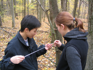
SU geography students tree coring! (Photo credit: Professor Jacob Bendix)
What is Physical Geography, You Might Ask?
It’s essentially the study of the physical processes that shape our natural world. This includes the study of water, land, soils, climate and the atmosphere. It’s composed of several specialty areas. Here are a few:
Geomorphology is the study landscapes and their formation throughout time.
Glaciologists study the interaction of ice sheets and the present climate, as well as the impact of glaciers on landscapes.
Biogeographers are interested in the spatial distributions of plants and animals across the planet.
Coastal geography is the study of the dynamic interface between the ocean and the land.
Meteorology examines the complex weather patterns on a day-to-day basis, while climatology is focused on long-term trends in weather.
Experience Physical Geography in Syracuse
No matter your focus, studies in Physical Geography will undoubtedly lead you out of the conventional classroom and into the outdoor classroom. You may find yourself taking samples at a local stream, or hiking a nearby mountain. Check out these great outdoors sites of study and recreation, right at Syracuse’s fingertips!
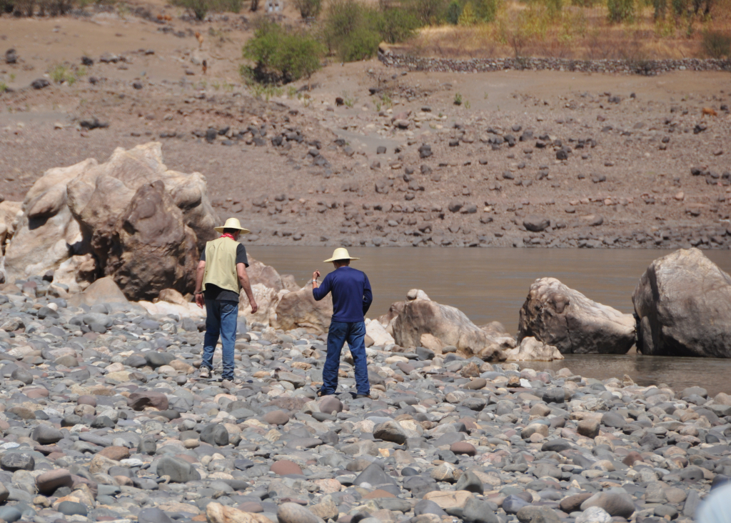
Professors Peng Gao and Jacob Bendix studying river bed load in China. (Photo credit: Jacob Bendix)
Green Lakes State Park, Fayetteville, NY
Located 20 minutes from campus, Green Lakes offers hiking, boating, and bird watching around its two beautiful lakes.
The park is comprised of Green Lake and Round Lake, which are both Meromictic. Only 11 lakes in the world can boast this same quality. Meromictic Lakes have two layers, like most lakes; but unlike most lakes, these two layers do not mix. This means that the top layer stays completely clear and free of sediment. You can enjoy these crystal clear lakes walking along the miles of trails within the part. In the winter, they’re used as cross-country skiing trails, and in the summer you can lounge on the sandy beach and even go for a swim in these unique waters!
You can also get involved in soil erosion and invasive species control volunteer projects at Green Lakes State Park. Click here for more information.
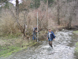
Students conducting a stream survey. (Photo credit: Jacob Bendix)
The Finger Lakes Region of NY
Just west of Syracuse lies the Finger Lakes Region spanning 9,000 square miles from the shores of Lake Ontario to the Pennsylvania border and encompassing 11 parallel lakes, plenty of navigable rivers, and more than 1,000 waterfalls. Cazenovia, Skaneateles, Otisco, and Oneida Lakes are closest to Syracuse. Carved out by continental glaciers, these beautiful lakes provide nearby areas of recreation and education.
Whether examining the effects of glaciation on their formation, the development of agriculture on their fertile surrounding areas, or invasive species, the region boasts a wealth of opportunities for academic study.
They’re also a great destination for students looking to get off campus. You can swim, fish, dive and boat the lakes, rivers, and waterfalls themselves, or explore their surrounding villages, museums, and farms!
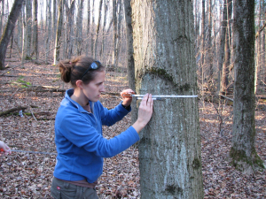
A student measuring a tree’s DBH, that is, diameter at breast height. (Photo credit: Jacob Bendix)
Chittenango Falls
Chittenango Falls is a 167-foot tall waterfall located in Madison County. The bedrock underneath the falls is over 400 million years old. The scenic waterfall is the main attraction of Chittenango Falls State Park. The falls were carved out by glacial sculpting. Around 57,000 visitors attend the park each year to enjoy a variety of recreational activities. An interesting variety of both plants and wildlife may be found along the trails, making the park a ripe area for study. Fun fact? Chittenango Falls is home of the endangered ovate snail!
Interestingly, the Chittenango creek used to be on the Environmental Protection Agency’s (EPA) list of impaired waters due to excessive nutrient loads caused by nearby farming operations (use of phosphorous-containing fertilizers that run-off into nearby waterways can cause nutrient and sediment loading). Fortunately, since farmers implemented a series of agricultural best practices, the creek’s water quality has since improved.
You can learn more about the problem and the EPA project to redress it, here. It’s just one example of a multitude of things you could study related to streams and water quality in the area!
List of Relevant Courses
Visit the SU Course Catalog for more info.
- GEO215 Global Environmental Change
- GEO 314 Hazardous Geographic Environments
- GEO 316 River Environments
- GEO 317 Mountain Environments
- GEO 318 Tropical Environments
- GEO 319 Cold Environments
- GEO 326 Weather and Climate
- GEO 327 Coastal Environments
- GEO 400 Geography of the Anthropocene
- GEO 455 Biogeography
- GEO 583 Environmental GIS
This is a non-exhaustive list. Become a major or minor to discover more!
Potential Careers
- Hydrologist
- USGS surveyor
- Researcher
- Outdoor guide
- Coastal zone manager
- Soil conservationist
- Agricultural extension agent
- Weather forecaster
And many, many more! For further reading on Geography careers, click here.